Luxury Expedition Routes: The Definitive Operational & Strategic Guide
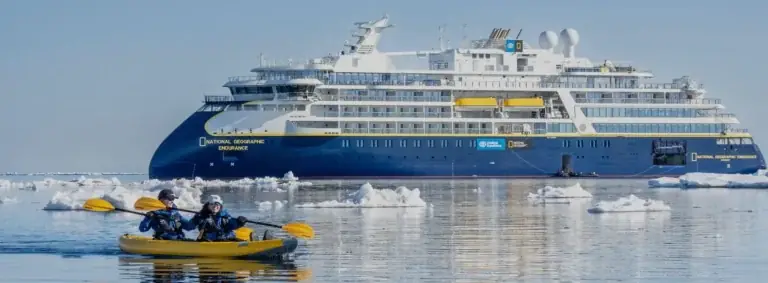
The global map of remote travel has undergone a fundamental transformation over the past three decades. Where navigational routes through extreme geographical biomes were once the exclusive domain of scientific research vessels, naval icebreakers, and heavily subsidized government expeditions, they are now routinely accessed by purpose-built private expedition yachts and specialized, low-capacity commercial vessels. Designing and executing passages through these remote marine corridors requires managing complex physical variables, shifting geopolitical jurisdictions, and delicate biological habitats.
A remote route is not merely a geometric line drawn across a nautical chart or flight path. It represents a continuous sequence of dynamic operational environments where weather patterns, ice concentrations, bathymetric uncertainties, and local regulatory permits interact in real time. When the luxury paradigm is integrated into these extreme environments, operational complexity increases significantly. The objective shifts from basic survival and transit to delivering absolute biological safety, operational redundancy, and high-level hospitality in regions lacking permanent shore infrastructure.
Analyzing remote expedition passages requires moving beyond promotional travel literature to evaluate the structural mechanics of maritime engineering, environmental law, fuel staging, and risk management. From high-latitude polar passages to shallow-draft equatorial archipelagoes, successful execution depends on rigorous planning, expert seamanship, and strict adherence to international safety and environmental conventions.
Understanding “luxury expedition routes.”

To evaluate luxury expedition routes with editorial and technical rigor, one must first dismantle common commercial misnomers. In mainstream travel marketing, the term “expedition route” is frequently applied to standard coastal transit lines that merely feature occasional stops at regional nature reserves or scenic viewpoints. However, an operational expedition corridor is fundamentally defined by its environmental severity, logistical isolation, and the necessity of self-contained support systems.
A key point of distinction lies between fixed, port-to-port cruise tracks and dynamic, condition-led expedition corridors. Conventional itineraries rely on guaranteed berth availability, localized municipal utilities, predictable sea states, and established emergency evacuation routes. In contrast, true expedition corridors cross regions where hydrographic data may be outdated, maritime assistance is days away, and weather phenomena actively dictate daily vessel movement.
Operational Route Spectrum
-
Standard Coastal Transit: Dependent on municipal ports, fixed berth bookings, stable coastal weather, and predictable daily schedules.
-
Semi-Remote Corridor: Operates near secondary ports with limited marine servicing, utilizing hybrid anchorage points and basic self-contained utility setups.
-
Autonomous Expedition Corridor: Operates in complete geographic isolation, requiring full onboard waste treatment, extended fuel endurance (>4,000 nautical miles), dynamic positioning capabilities, and variable, weather-led routing.
Failing to appreciate these distinctions leads to severe planning miscalculations. Treating an expedition passage like a standard cruise track creates unrealistic expectations regarding arrival timelines, shore accessibility, and onboard connectivity. True luxury along these corridors is not defined by static itineraries, but by operational margin, advanced navigation hardware, expert leadership, and uncompromised safety in unpredictable environments.
Deep Contextual Background: The Evolution of Global Remote Routes
The operational mapping of remote transit corridors traces its roots back to early naval surveys, trade route discoveries, and polar exploration efforts. Early maritime passages through regions like the Northwest Passage, the Northern Sea Route, or Drake Passage were characterized by high mortality rates, prolonged vessel entrapment, and severe physical hardship. Navigation relied entirely on celestial observations, lead-line depth soundings, and rudimentary ice scouting from the masthead.
During the mid-20th century, the expansion of oceanographic research and military presence during the Cold War drove major advancements in icebreaking technology, hydrographic mapping, and satellite observation. Decommissioned research ships and commercial offshore supply vessels demonstrated that properly engineered hulls could navigate high-latitude and deep-ocean corridors with high reliability. These industrial platforms laid the structural foundation for modern explorer superyachts and expedition ships.
Historical Route Evolution Timeline
-
1800s–1950s (Exploration & Naval Survey Era): High-risk, unmapped passages executed by wooden or early steel scientific vessels with minimal communication capabilities.
-
1960s–1990s (Industrial & Conversion Era): Utilization of refitted research hulls, naval icebreakers, and commercial supply ships to establish repeatable seasonal corridors.
-
2000s–Present (Purpose-Built Explorer Era): Introduction of PC5/PC6 Polar Code-compliant private vessels, dynamic positioning, forward-looking sonar, and real-time satellite ice tracking.
Recent developments in global maritime regulations have further refined how these corridors are navigated. The adoption of the International Maritime Organization’s (IMO) Polar Code, alongside strict Regional Marine Sanctuary restrictions, EPA Tier 4 engine emission standards, and zero-discharge environmental rules, has reshaped route design. Modern expedition passages must account not only for physical hazards, but also for strict regulatory compliance across international waters and exclusive economic zones (EEZs).
Conceptual Frameworks and Mental Models for Route Design
Designing and executing passages through remote environments requires structured analytical frameworks to evaluate feasibility, balance operational risk, and allocate fuel and material resources effectively.
The Route Viability Index (RVI)
The RVI framework evaluates the operational risk profile of a proposed route by measuring four primary variables:
-
Environmental Volatility: Sea ice concentration, wind shear, tidal surges, and ambient temperature extremes.
-
Logistical Separation: Distance to the nearest deep-water refuelling port, qualified marine repair facility, or Level 1 trauma center.
-
Regulatory Compliance Load: Flag state authorizations, local indigenous territory permits, coastal state passage rights, and environmental discharge prohibitions.
-
Asset Enduring Range: Onboard fuel burn rates, freshwater generation capacity, blackwater storage limits, and food storage autonomy.
The Dynamic Contingency Envelope (DCE)
The DCE model evaluates a vessel’s ability to pivot when environmental conditions close off a primary passage corridor. Rather than relying on a single linear track, expedition leaders establish primary, secondary, and tertiary operational corridors within a geographic region.
-
Unacceptable Exposure Zone: Operating in high-severity environments without secondary shelter anchorages or beyond the operational range of rotary/fixed-wing evacuation support.
-
Balanced Expedition Envelope: Pushing into remote marine zones supported by forward-looking sonar, dynamic station-holding, and redundant fuel reserves.
This framework prevents crews from attempting dangerous passages simply to maintain a pre-planned schedule, reinforcing that safety and adaptability govern route decisions.
Key Categories and Operational Variations
Expedition passages vary significantly based on regional geography, water depth, ice density, and climate conditions. The table below outlines major operational categories:
| Corridor Category | Core Vessel Requirements | Optimal Operational Window | Primary Route Hazard | Regulatory Complexity |
| High-Arctic Passages (Northwest Passage / Svalbard) | PC5/PC6 Ice-class hull, dual ice searchlights, redundant bow thrusters | July – September | Dynamic sea ice drift, uncharted shoals, rapid fog formation | Extremely High (Polar Code, Canadian/Danish territorial permits) |
| Sub-Antarctic & Antarctic Peninsula | Heavy displacement hull, dynamic positioning, long-range fuel tanks | November – March | Extreme Drake Passage swells, katabatic winds, icebergs | Very High (Antarctic Treaty System, IAATO operational guidelines) |
| Equatorial Archipelagoes (Raja Ampat / Melanesia) | Shallow draft (<3 m), forward sonar, high-capacity watermakers | Variable (monsoon-dependent) | Uncharted coral pinnacles, narrow reef passages, strong currents | High (Customs clearance across island chains, marine park fees) |
| Sub-Polar Fjords (Southeast Alaska / Patagonia) | High maneuvering clearance, AWTP systems, heavy anchor gear | May – September | Glacial growler ice, extreme tidal range, narrow channel traffic | High (USCG/Chilean Navy protocols, National Park entry limits) |
| Remote Oceanic Atolls (Tuamotus / Pitcairn) | Deep-sea stabilization, redundant desalination, high-speed tenders | April – October | Open ocean swells, lack of protected anchorages, deep drop-offs | Moderate to High (EEZ entry permits, remote customs protocols) |
Decision Logic for Corridor Navigation
Selecting the appropriate navigation strategy depends on clear decision criteria:
-
High-Latitude / Polar Corridors:
-
Ice Density > 4/10ths: Ice-Class Steel Hull (PC5/PC6) required; navigate using forward-looking sonar and satellite ice radar.
-
Open Water with Growlers: High-intensity LED/xenon searchlights required; maintain active ice watches and reduce speed to minimum steerage.
-
-
Shallow Equatorial / Coral Corridors:
-
Shallow Seabed (< 5 meters): Shallow-draft displacement hull or catamaran required; deploy forward tenders equipped with depth sounders.
-
Protected Sanctuary Zones: Engage Dynamic Positioning Systems (DPS) to station-hold without dropping anchors on fragile reefs.
-
Detailed Real-World Scenarios
To understand how operational variables intersect during deep-field navigation, consider the following detailed operational scenarios:
Navigating the Bellot Strait in the Northwest Passage
-
Operational Setting: Narrow maritime corridor connecting Prince Regent Inlet and Peel Sound.
-
Core Constraints: Extreme tidal currents (up to 8 knots), heavy sea ice floes entering from both ends, shallow granite pinnacles, complete absence of local navigational aids.
-
Decision Sequence: The master waits at the eastern entrance until high slack water to minimize current drag. A forward-scouting RIB equipped with portable bathymetric sonar checks ice accumulation at the narrowest point. The vessel engages dual radar systems and forward-looking sonar, proceeding at 4 knots with main propulsion on direct bridge control.
-
Failure Mode & Mitigation: Multi-year sea ice blocks the western exit while the tide reverses. The vessel uses dynamic station-holding in a semi-protected cove along the northern shore, waiting out the tidal cycle until the wind shifts ice away from the passage.
Deep-Fjord Transit in the Chilean Channels
-
Operational Setting: Messier Channel and Eyre Fjord in Southern Patagonia.
-
Core Constraints: Unpredictable katabatic winds exceeding 60 knots, uncharted submerged rocks, heavy glacial calving debris, strict Chilean Navy reporting checkpoints.
-
Decision Sequence: The bridge team maintains hourly position reporting with local maritime authorities. Engine room operators switch fuel filtration to active dual-bank monitoring to handle increased sediment turbulence in storm conditions. Anchor watches are doubled when entering glacial bays.
-
Failure Mode & Mitigation: Sudden katabatic gusts cause anchor drag on a steep fjord drop-off during shore operations. Dynamic positioning automatically engages to hold station, allowing the crew to retrieve the anchor and maneuver into open water without grounding.
Planning, Cost, and Resource Dynamics
The financial structure of running remote expedition routes differs significantly from traditional commercial yachting. Capital allocation is heavily weighted toward fuel reserves, environmental permits, specialized pilotage, and emergency contingency funding.
Operational Cost Distribution
-
Fuel & ECA-Compliant Lubricants: ~25% of operational budget.
-
Capital Asset Depreciation & Hull Insurance: ~35% of operational budget.
-
Specialized Pilotage, Permits & Legal Compliance: ~15% of operational budget.
-
Specialized Crew, Ice Pilots & Medical Personnel: ~12% of operational budget.
-
Provisions, Freight & Remote Logistics: ~8% of operational budget.
-
Emergency Risk Reserve & SAR Insurance Riders: ~5% of operational budget.
Direct and Indirect Financial Estimates
| Cost Category | Estimated Range (USD) | Primary Cost Drivers and Variability |
| ECA-Compliant Ultra-Low Sulfur Fuel | $80,000 – $250,000 / month | Remote bunkering tanker fees, regional price premiums |
| Mandatory Ice Pilotage & Local Pilots | $3,000 – $10,000 / week | Regional maritime regulations, passage length |
| Environmental & Coastal Entry Permits | $5,000 – $40,000 / route | Marine park access fees, national park quotas |
| Aviation Support / Helicopter Staging | $20,000 – $100,000 / charter | Flight positioning, remote fuel drum transport |
| Offshore Medical Evacuation Riders | $8,000 – $30,000 / deployment | Distance to Level 1 trauma centers, regional SAR capability |
Tools, Strategies, and Support Systems
Navigating complex remote corridors requires integrating specialized hardware, real-time software analytics, and experienced personnel.
Integrated Navigation Architecture
-
Hardware Layer: Dual X-band and S-band radar arrays, forward-looking multibeam sonar, xenon ice searchlights, and satellite communication terminals.
-
Data & Software Layer: Real-time ECDIS mapping, high-resolution bathymetric survey feeds, GRIB weather modeling, and optical satellite ice density imagery.
-
Personnel Layer: Certified ice pilots, local indigenous guides, wilderness emergency physicians, and marine engineers.
Essential Operational Tools
-
Multibeam Forward-Looking Sonar (FLS): Provides real-time 3D profiling of the water column ahead of the vessel, detecting uncharted pinnacles or submerged icebergs.
-
Dual LEO and L-Band Satellite Arrays: Combines high-speed LEO bandwidth (Starlink Fleet) for weather data with fail-safe L-band links (Iridium Certus) for voice and distress signaling.
-
Advanced Wastewater Treatment Plants (AWTP): Ensure continuous compliance in zero-discharge marine sanctuaries without needing frequent shore pump-outs.
-
Heavy-Duty Commercial RIBs: Aluminum-hulled tenders with twin engines and independent navigation systems for safe shore insertions along rocky coastlines.
-
Onboard Hyperbaric & Medical Chambers: Specialized medical suites designed for remote medical stabilization prior to long-distance evacuations.
Risk Landscape and Failure Modes
Remote maritime navigation carries operational risks that require systematic evaluation. A minor mechanical or administrative issue can quickly escalate into a serious operational hazard in isolated waters.
Compounding Risk Chain
-
Initial Equipment Failure: Auxiliary generator cooling line becomes clogged by glacial silt or organic debris.
-
Loss of Redundant Power: Vessel loses secondary electrical capacity, forcing non-essential systems (including freshwater makers) offline.
-
Secondary Environmental Exposure: Strong tidal currents drift the vessel toward an uncharted rock formation while repairs are underway.
-
Systemic Escalation: Structural hull damage occurs, requiring an offshore Search and Rescue (SAR) deployment in severe weather conditions.
Risk Taxonomy
-
Regulatory Violation: Entering protected territorial waters or marine parks without proper permits, resulting in vessel arrest, heavy fines, or loss of charter licenses.
-
Environmental Impact: Accidental grounding or fuel spill in pristine ecological zones, triggering severe financial and environmental remediation liabilities.
-
Supply Chain Interruption: Failure of fuel delivery tankers or food supply shipments at intermediate staging ports, forcing route cancellation.
-
Remote Medical Crisis: Serious injury or illness occurring days away from advanced trauma facilities during adverse flying weather.
Governance, Maintenance, and Long-Term Adaptation
Operating across remote international corridors requires continuous administrative oversight, rigorous preventive maintenance, and adaptive planning.
Annual Route Maintenance & Inspection Cycle
-
Q1 (Winter Refit & Drydock): Structural hull non-destructive testing (NDT), propeller shaft alignment, SCR emissions testing, and sea valve overhauls.
-
Q2 (Regulatory & Flag Audit): USCG/Class surveyor inspections, Polar Code safety certification renewals, and updating emergency action plans.
-
Q3 (Seasonal Deployment): Execution of planned remote passages supported by real-time monitoring and dynamic weather routing.
-
Q4 (Post-Passage Debrief): Debriefing bridge and engineering teams, updating regional bathymetric logs, and reviewing logistical supplier performance.
Pre-Passage Operational Checklist
-
Confirm all flag state clearances, coastal state cruising permits, and marine sanctuary authorizations are valid.
-
Inspect main engine, auxiliary generators, steering gear, and emergency fire pump systems.
-
Verify full functionality of forward-looking sonar, radar systems, and satellite communication arrays.
-
Audit onboard medical supplies, pharmaceuticals, and emergency oxygen reserves.
-
Cross-check fuel and lube oil reserves against projected consumption rates, including a 30% emergency reserve margin.
-
Conduct comprehensive crew and passenger safety drills focusing on cold-water survival, abandon-ship protocols, and tender operations.
Measurement, Tracking, and Evaluation
Evaluating the success of a remote passage requires monitoring quantitative operational metrics alongside qualitative environmental and guest safety outcomes.
Passage Performance Indicators
-
Leading Metrics:
-
Pre-departure maintenance resolution rate for critical bridge and engine systems.
-
Accuracy of pre-voyage fuel burn calculations compared to real-world test runs.
-
Lead time secured for regional environmental and passage permits.
-
Specialized certification levels of bridge officers and field guides.
-
-
Lagging Metrics:
-
Unplanned mechanical downtime hours during the passage.
-
Actual fuel expenditure vs. preliminary Advanced Provisioning Allowance (APA) budgets.
-
Zero-discharge environmental compliance records throughout sanctuary transits.
-
Overall percentage of planned route objectives completed safely.
-
Documentation Standards
Professional expedition operators maintain detailed operational logs for legal, environmental, and safety records:
-
Environmental Discharge Logs: Precise tracking of treated blackwater, oily water separator operations, and solid waste storage for USCG and MARPOL audits.
-
Master Bridge & Hydrographic Logs: Real-time recording of localized weather, ice concentrations, depth soundings in poorly charted areas, and speed adjustments in mammal protection zones.
-
Post-Voyage Passage Reports: Comprehensive reviews documenting anchorage safety, local pilot performance, fuel quality, and updated navigational notes for future passages.
Common Misconceptions and Oversimplifications
-
Misconception 1: Any modern superyacht can safely navigate polar or deep remote corridors.
-
Correction: Vessel size does not guarantee remote capability. Without ice-strengthened hulls, specialized bow structures, dynamic positioning, and extended fuel autonomy, standard luxury yachts face severe structural and operational hazards in high-latitude waters.
-
-
Misconception 2: Satellite maps eliminate the danger of navigating remote coastlines.
-
Correction: Satellite imagery cannot measure water depth or detect underwater rocks and ice pinnacles. Real-time forward-looking sonar and visual watches remain essential.
-
-
Misconception 3: Expedition passages follow strict, unchangeable daily schedules.
-
Correction: Dynamic environmental factors like sea ice, katabatic winds, and swell patterns dictate daily movement. Flexibility is required to ensure safety.
-
-
Misconception 4: High vessel speed is an advantage during remote passages.
-
Correction: Navigating remote corridors prioritizes fuel efficiency, structural preservation, noise reduction for marine life, and low speeds to avoid uncharted hazards.
-
-
Misconception 5: High charter fees guarantee complete protection from physical discomfort.
-
Correction: Capital investment buys safety margins, operational redundancy, and expert leadership, but passengers must still adapt to natural sea states, cold weather, and changing itineraries.
-
Ethical, Practical, and Environmental Considerations
Navigating remote corridors through fragile wilderness biomes carries significant ecological responsibilities. Increased vessel traffic in isolated regions can impact wildlife habitats and local communities if not managed carefully.
Triple-Bottom-Line Expedition Model
-
Ecological Stewardship: Enforcing strict zero-discharge waste protocols, maintaining low acoustic footprints to prevent marine mammal disturbance, and avoiding anchoring on fragile sea beds.
-
Regulatory Compliance: Adhering fully to international maritime law, regional marine sanctuary guidelines, and local environmental protection codes.
-
Cultural Respect: Engaging respectfully with indigenous communities, utilizing local guides, and supporting local economies at remote landing sites.
Vessel captains and expedition leaders adopt low-impact operational practices:
-
Acoustic Noise Management: Reducing generator and engine vibration in marine mammal habitats to prevent underwater acoustic disruption.
-
Dynamic Station-Holding: Utilizing dynamic positioning systems instead of anchors in sensitive benthic environments, such as deep-water coral beds or eelgrass fields.
-
Community Engagement: Sourcing local supplies where sustainable and working directly with indigenous conservation programs along remote transit routes.
Conclusion
Executing passages along global luxury expedition routes requires balancing high-level hospitality with rigorous maritime engineering, regulatory compliance, and environmental stewardship. As interest in remote exploration grows, understanding the operational realities of these corridors becomes increasingly important for yacht owners, charterers, and expedition leaders.
Long-term success in navigating remote marine environments depends on thorough preparation, continuous risk evaluation, environmental respect, and adaptive decision-making. When managed with professional rigor and analytical discipline, expedition passages offer safe, extraordinary access to the world’s most remote environments.